From Washington to you
2001 Nisqually Earthquake
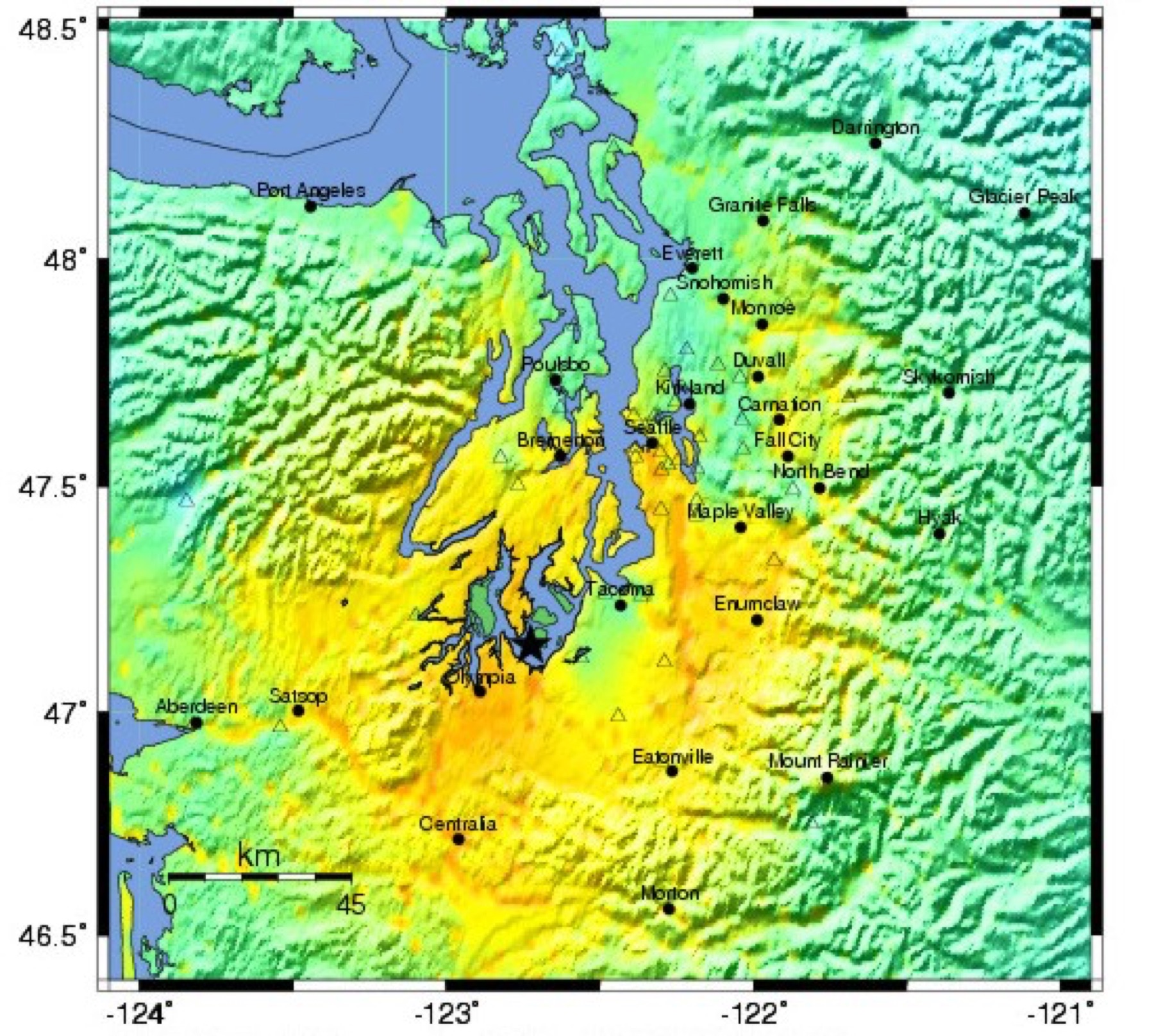
Nisqually earthquake epicenter · Thurston County · February 28, 2001
A deep magnitude 6.8 shock under Puget Sound injured about 400 people and forced a disaster declaration covering 24 counties.
The Nisqually earthquake (Mw = 6.8) occurred in the Puget Sound area of western Washington on February 28, 2001. The USGS National Strong-Motion Program records the origin time as 18:54 UTC (10:54 AM PST). USGS Open-File Report 02-346 lists the epicenter as 47.149° N, 122.727° W, at a depth of 52 km. USGS says the event was similar in mechanism to the April 13, 1949, Puget Sound earthquake (Mw = 7.1) and the April 29, 1965, Seattle earthquake (Mw = 6.7).
The shock produced strong shaking over a wide area and damaged Olympia, Seattle, and Tacoma. In all, 24 counties and 25 Indian reservations were included in a Presidential Disaster Declaration issued March 1, 2001. One fatality is attributable to the earthquake and 400 persons sustained injuries. Liquefaction was widespread in parts of Olympia and South Seattle, and several significant lateral spreads, embankment slides, and landslides occurred.
USGS Open-File Report 02-346 assigned traditional USGS MMI 8 to the Sodo area of Seattle. At the lowest intensities the earthquake was felt over approximately 350,000 square km (approximately 135,000 square miles) in Washington, Oregon, Idaho, Montana, and southern British Columbia.
- Geography & Geology
- History
- Science / Strange Washington
Sources (3)
government · Tier S
U.S. Geological Survey, National Strong-Motion Program20010228 Nisqually, Washington, Mw 6.8 Earthquake Data
government · Tier S
U.S. Geological SurveyIntensity distribution and isoseismal maps for the Nisqually, Washington, earthquake of 28 February 2001
government · Tier S
U.S. Geological SurveyPreliminary analysis of landslide and ground-failure economic losses from the February 28, 2001, Nisqually, Washington, earthquake
Last reviewed: September 20, 2026
Keep wandering
same arc
1949 Olympia EarthquakeA magnitude 7.1 shock under south Puget Sound on April 13, 1949, killed eight people and wrecked nearly every tall building in Olympia.
same arc
1965 Puget Sound EarthquakeA magnitude 6.5 shock between Seattle and Tacoma on April 29, 1965, killed seven people.
same arc
Cascadia Subduction ZoneA quiet plate boundary runs from California to British Columbia — and under Washington.
nearby
Hiram M. Chittenden LocksTwo concrete chambers in Ballard lift ships between Puget Sound and Seattle's lakes — and pass salmon the other way.
same arc
Seattle FaultA roughly 70-kilometer thrust under Seattle can host a magnitude 7 to 7.5 earthquake. USGS says the last large one was close to the year 900.