From Washington to you
Cascadia Subduction Zone
Washington coast · Clallam County · 18th century to present
A quiet plate boundary runs from California to British Columbia — and under Washington.
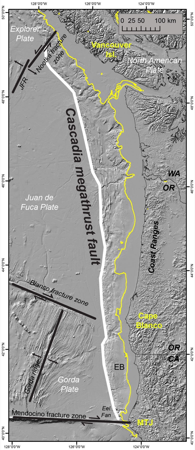
The Cascadia subduction zone is a 1,300-kilometer tectonic boundary. Offshore, the Juan de Fuca and Gorda plates converge with North America and slide beneath the continent. USGS maps the zone from northern California to southern British Columbia, from well offshore into eastern Washington and Oregon.
The interface is a megathrust fault. Stress builds there until the fault slips. Subduction-zone earthquakes are the largest on Earth and can exceed magnitude 9. They are also known to generate large tsunamis.
Cascadia is unusual among textbook subduction zones for its extraordinarily low instrumentally recorded earthquake rates. Seven of its volcanoes have erupted since the start of the 18th century. The sources below are the public USGS record of the plate boundary and its marine geohazards.
- Geography & Geology
- Science / Strange Washington
Sources (2)
government · Tier S
U.S. Geological SurveyCascadia
government · Tier S
U.S. Geological SurveyCascadia Subduction Zone Marine Geohazards
Last reviewed: September 20, 2026
Keep wandering
same arc
1949 Olympia EarthquakeA magnitude 7.1 shock under south Puget Sound on April 13, 1949, killed eight people and wrecked nearly every tall building in Olympia.
same arc
2001 Nisqually EarthquakeA deep magnitude 6.8 shock under Puget Sound injured about 400 people and forced a disaster declaration covering 24 counties.
same arc
Copalis Ghost ForestWestern red cedars at the Copalis River died between the 1699 and 1700 growing seasons — killed when Cascadia dropped the coast.
same arc
Glacier PeakWashington's most remote active volcano is easy to miss from the cities — and has produced some of the biggest eruptions in the Lower 48.
same arc
Mount RainierThe highest Cascade peak is also the most threatening volcano in the range — not for lava, but for mud.
same arc
Mount St. HelensOn a clear May morning, the north side of the mountain gave way.
same arc
Seattle FaultA roughly 70-kilometer thrust under Seattle can host a magnitude 7 to 7.5 earthquake. USGS says the last large one was close to the year 900.