From Washington to you
Ice Age Floods
Ice Age Floods National Geologic Trail · Grant County · about 18,000–15,000 years ago
NPS says that 18,000 to 15,000 years ago an ice dam in northern Idaho failed, sending Glacial Lake Missoula across Washington and down the Columbia.
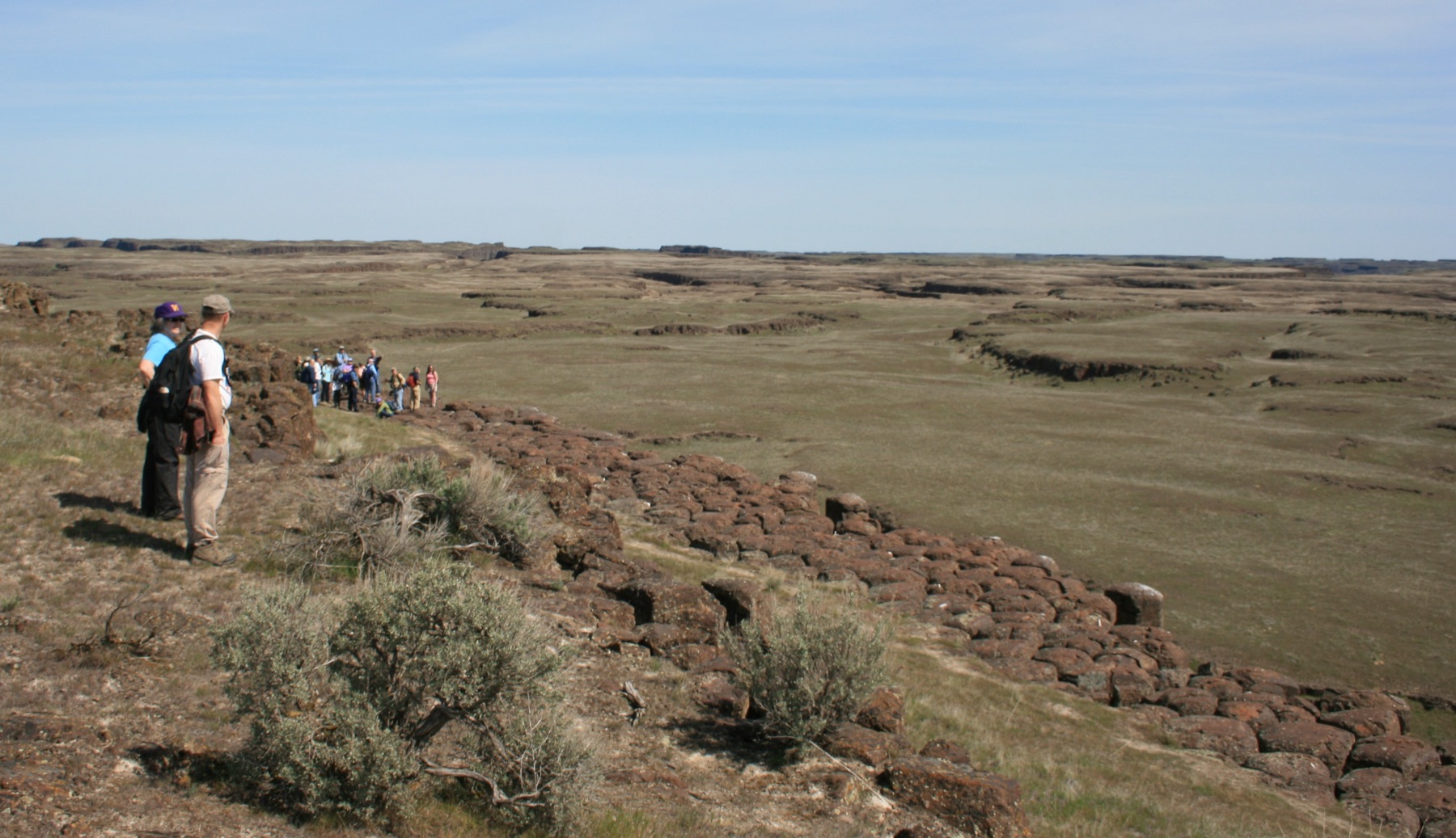
The Ice Age Floods National Geologic Trail follows the path of the Missoula Floods. NPS says that 18,000 to 15,000 years ago an ice dam in northern Idaho created Glacial Lake Missoula, stretching 3,000 square miles around Missoula, Montana. The dam burst. Floodwaters crossed Washington, ran down the Columbia into Oregon, and reached the Pacific.
In the 1920s, J Harlen Bretz argued that a catastrophic flood carved the Channeled Scabland. Joseph Pardee of the U.S. Geological Survey later pointed to Glacial Lake Missoula as the source. NPS says the idea was not generally accepted until the late 1970s.
This card is the trail and the floods. Dry Falls, Drumheller Channels, and Palouse Falls are the place cards. The sources below are the National Park Service Ice Age Floods pages.
- Geography & Geology
- Science / Strange Washington
Sources (3)
government · Tier S
National Park ServiceIce Age Floods National Geologic Trail
government · Tier S
National Park ServicePark Brochure — Ice Age Floods National Geologic Trail
government · Tier S
National Park ServicePeople
Last reviewed: September 20, 2026
Keep wandering
same landscape
Drumheller ChannelsA cascade of buttes and basins west of Othello is the Ice Age Floods landscape the National Park Service calls the most spectacular of its kind.
same landscape
Dry FallsA 3.5-mile cliff in the Grand Coulee is the lip of a waterfall that once dwarfed Niagara.
same landscape
Ginkgo Petrified ForestOne of North America's most diverse fossil forests sits above the Columbia at Vantage — and petrified ginkgo turned up here in 1932.
same landscape
Grand CouleeA dry canyon about 50 miles long holds the geologic story of a river that lost its channel — until people flooded part of it as Banks Lake.
same landscape
Moses Coulee Gravel BarA teardrop of pebble-cobble gravel 3.2 miles long and 240 feet high — perhaps the largest flood bar in the Channeled Scabland.
same landscape
Palouse FallsA 200-foot drop in a Palouse coulee is the state waterfall, carved when Ice Age floods rerouted a river from the Columbia to the Snake.
same landscape
Wallula GapIce Age floodwaters hit a two-mile gap that could not pass them all — and backed up into a temporary lake 900 feet deep.